 Norsk
Norsk
Engelskbukta [78° 50' N 11° 50' E]By Øystein Overrein (ed.), Jørn Henriksen, Bjørn Fossli Johansen, Kristin PrestvoldThe fjord of Engelskbukta offers hiking with great views of the sea, glaciers and mountains. It was called Cove Comfortless by the English and was central in the early whaling period, in the beginning of the 17th century. There are several good landing sites along a beach stretch of five kilometres. 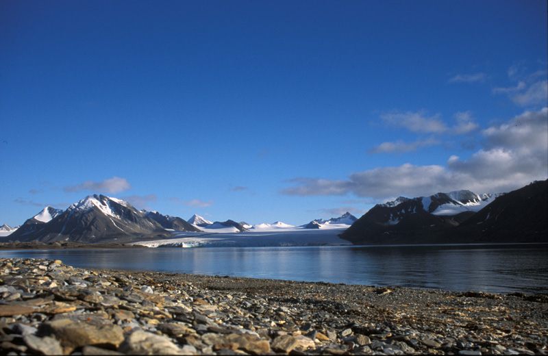 Take care:

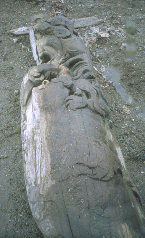

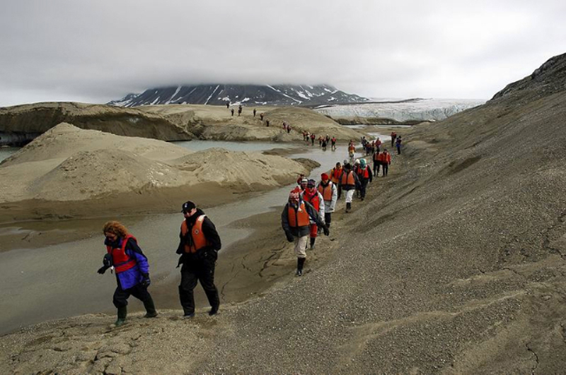
The area is nicely located with the mountains on the peninsula of Brøggerhalvøya to the east, a view of the island of Prins Karls Forland to the west, and to the south-east a view to the great glaciers of Uvêrsbreen and Comfortlessbreen terminating at Engelskbukta. If we turn southwards, we see the spit of Sarstangen stretching several kilometres out into the sound of Forlandsundet. The spit continues underwater, crossing the sound, as the Forlandsrevet reef. In front of Comfortlessbreen the moraine spit, composed of deposits from Uvêrsbreen, provides sheltered waters, and the ice stays quite long into the summer. Under these conditions the area serves as a popular haul-out site for bearded seals. HistoryAt the start of the 17th century, Svalbard acted as a magnet for the sailing ships that came north for the whaling. Ships and sailors from many western European countries came to participate. The prospects for good economic yields set the scene for friction, competition and rivalry between the whaling nations. Contested hunting rights and the rights to the best whaling grounds were finally settled between England and the Netherlands. Through a compromise, the whaling grounds were split between them. The English were granted rights to whaling south from the fjord of Magdalenefjorden, while the Dutch controlled the areas north of this fjord, situated in the north-western corner of Spitsbergen. As a part of this agreement, Engelskbukta was given to the English. The bay was used a lot by English whalers in the 17th century. Written sources state that they built a whaling station in the bay. On the maps of Gerritz (1613) and the Muscovy Company (1625) the bay was called Cove Comfortless, a name supposedly stemming from the story of the sailing ships Mary Margaret and Elisabeth. In 1611, the English trading company the Muscovy Company, equips two ships for a first try at whaling in Svalbard. The ships are Mary Margaret, 150 tons, and Elisabeth, 50 tons. The leaders of the expedition are Jonas Poole and Thomas Edge, both well known in the waters around Svalbard after several previous voyages to the area. Mary Margaret is equipped for whaling, and six men from the Bay of Biscay join the expedition to help the English with the catching. Mary Margaret and Elisabeth set sails from Blackwell, England, early April, anchoring in the harbour of Ebeltofthamna in Krossfjorden in late May. Written sources indicate that Ebeltofthamna was the first English harbour in Svalbard. It is also the harbour housing the oldest English whaling station. History tells that the sailing ship Mary Margaret heads south to Cove Comfortless north in Forlandsundet, where she is pushed ashore by the ice and destroyed, but the sailors onboard manage to kill 500 walruses before she is shipwrecked. The ship is crushed by the ice whilst the sailors are on land, busy boiling oil from the walrus blubber. Meanwhile, Jonas Poole has sailed north and south along the Spitsbergen coast with Elisabeth to map the land and its resources. He is informed of Mary Margaret’s shipwreck while at Bjørnøya (Bear Island) and sails back to rescue men and cargo. He has trouble sounding the depths through Forlandsundet to reach the damaged ship, but finally makes it. Here he finds that some of the crew from Mary Margaret have reached Thomas Marmaduke from Hull, an independent shipmaster without affiliation to any English trading company. Such independent captains are often viewed as privateer captains and adventurers. The crew has persuaded him to help rescue all of the oil and transport it back home, in exchange for a sum of money. Thomas Marmaduke does not leave Cove Comfortless after Elisabeth’s arrival, to Jonas Poole’s great dissatisfaction and irritation. In a joint effort to finish up the oil boiling, the crew of both ships load Elisabeth so full of oil that she capsizes. Jonas Poole nearly perishes, and only just manages to get out of the hold. The shipwrecked seamen from both ships are transported with Marmaduke back to Hull in England. For a price, he also brings as much of the cargo they can save. That is how the English actually manage to lose both their sailing ships that year. Edge later writes that the only fruitful outcome of the summer of 1611 was that the six Basques onboard managed to kill a whale – the first whale caught and killed off Spitsbergen. In this way they wrote history and launched the whaling era in Svalbard, terminating 200 years later after almost complete extinction of the bowhead whale in these waters. In the year 2000, a galleon from an old sailing ship was found at the headland of Poolepynten on the west side of Forlandsundet. The well preserved galleon showed a lion with a crown. It came from a ship that was shipwrecked in these waters around 400 years ago. Landing sitesThere are many accessible landing sites along Kiærstranda and Leinstranda. Just off Uvêrsøyra, on the north side of the bay, there is a usable landing site. Another (better) alternative is to land by punt on the moraines between Uvêrsbreen and Comfortlessbreen. Watch out for muddy areas! Updated March 2015 |
The Cruise Handbook is also available in book formHard cover with numerous pictures - 249 pages - NOK 249.00 Norwegian Polar Institute |